CONONDALE GREAT WALK
Bolumba Creek Day-Use-Area
56KM – 3 – 4 day walk – Grade 4 walk A range of walking experiences are offered within this great walk—from short strolls to the challenging four day, 56km, full circuit walk. Whichever you choose—the Conondale Range Great Walk offers an adventure to remember! Day 1: Booloumba Creek section – 11k Day 2: Mount Gerald – Peters Creek section: 17k Day 3: Peters Creek – Summer Falls section: 15.2k Day 4: Mount Allan – Booloumba Creek section: 12k From Kenilworth travel south on the Maleny Kenilworth Road for 7km before turning right onto Booloumba Creek Road. Travel a further 5km along this road to the entrance of the park. From here on, the road is unsealed and you will need a High Clearance 4WD as there a number of creek crossings. After 1km you will reach the Day Use Area on the right, where you can park. LINK TO AUSSIE BUSHWALKING SITE |
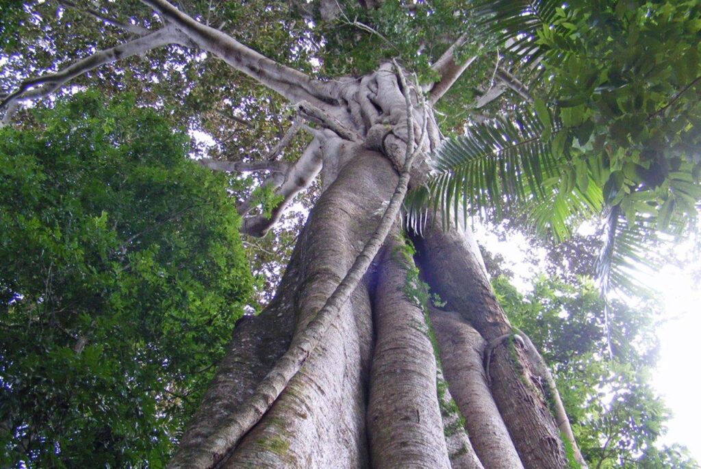
FIG TREE WALK
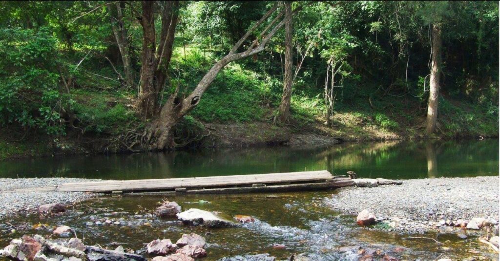
Little Yabba Creek
780m (allow 45 minutes) Grade 1 Stand in awe beneath magnificent, 150 year-old Moreton Bay fig tree and take in the towering canopy of piccabeen palms, flooded gums and white cedars. Utilise the wheelchair – accessible boardwalk to explore this walk. Lister for the multitude of birds always present in the forest. The circuit starts from the day-use area at Little Yabba Creek on the Maleny-Kenilworth road. You then walk 150m on the footpath beside the Kenilworth-Maleny Road to the start of the circuit track. Please be careful as the road can be busy. To reach Little Yabba Creek day-use area, from Kenilworth drive 7km south on the Maleny–Kenilworth Road, 150m past the intersection with Sunday Creek road. Accessible by 2WD conventional vehicle Wheelchair access – YES – This track is wheelchair accessible -may require assistance. LINK TO DES MAP & MORE INFORMATION HERE |
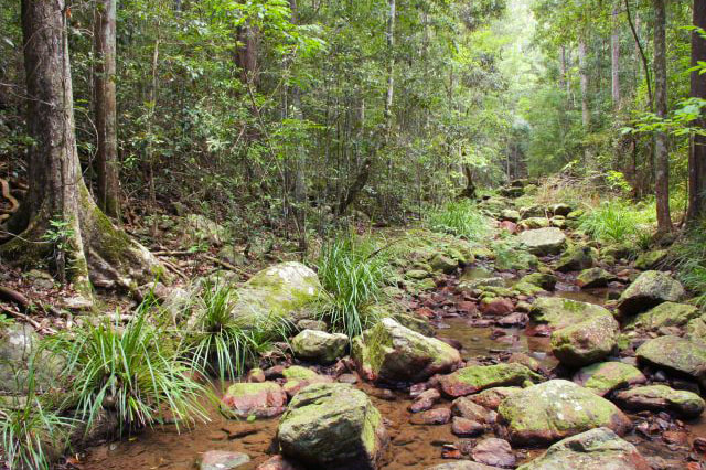
AMAMOOR CREEK HIKING TRAIL
Amamoor Creek Camping Area
Walk 2.5km circuit (Allow 2 hr 30min) Grade 4 walking track A hiking trail through open, eucalypt forest and through forest with an interesting mix of rainforest plants. The trail starts at teh Amamoor Creek Camping Area and heads East then branches North to start the loop trail. The trail finshes in the same locationb but takes the walker on a different return path. There are some challenging sections and a moderate fitness level is required. Amamoor Creek Camping Area lies aproximately 16 km from Amamoor township and 12km along Amamoor Creek Road from the park entrance. You travel past the Amama Day-Use Area and Cedar Grove Camping Area on the way. Caution is required in wet weather, the creek can rise quickly during heavy rainfall cutting off access. Accessible by conventional vehicle. LINK TO DES MAP & MORE INFORMATION |
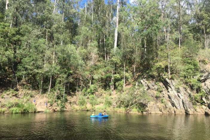
Amamoor State Forest
In this forest you will find dry forests, riverine rainforests as well as hoop and bunya pine plantations. The Gympie Muster site is in the heart of the forest. On your drive there, you will pass Amarma day-use area which is perfect for day visitor picnics and is at the start of a number of walks. Then Ceder Grove camping area which also has a number of walks and near to the muster site you will reach Amamoor Creek camping area where you can walks to the and cool off in the warmer months.
Amamoor features dry eucalypt forests with riparian rainforests fringing Amamoor Creek. All three recreational areas are located beside the picturesque creek. The creek provides important habitat for many animals including platypus, which are active during dusk and dawn busily forage for food, and several rare and endangered frogs. There are excellent locations along the creek to birdwatch and, if you’re lucky, spot platypus swimming in the creek. The surrounding state forest produces some of the best plantation hoop pine in Queensland. Location – About 180km north of Brisbane, inland from the Sunshine Coast, along the Amamoor Creek Road. Camping Grounds
|
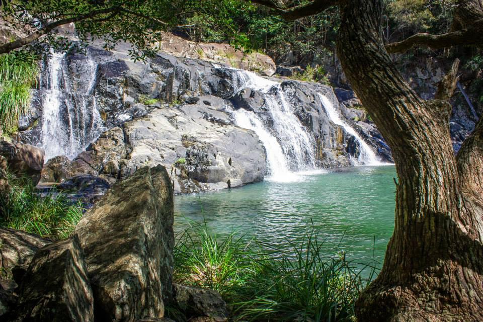
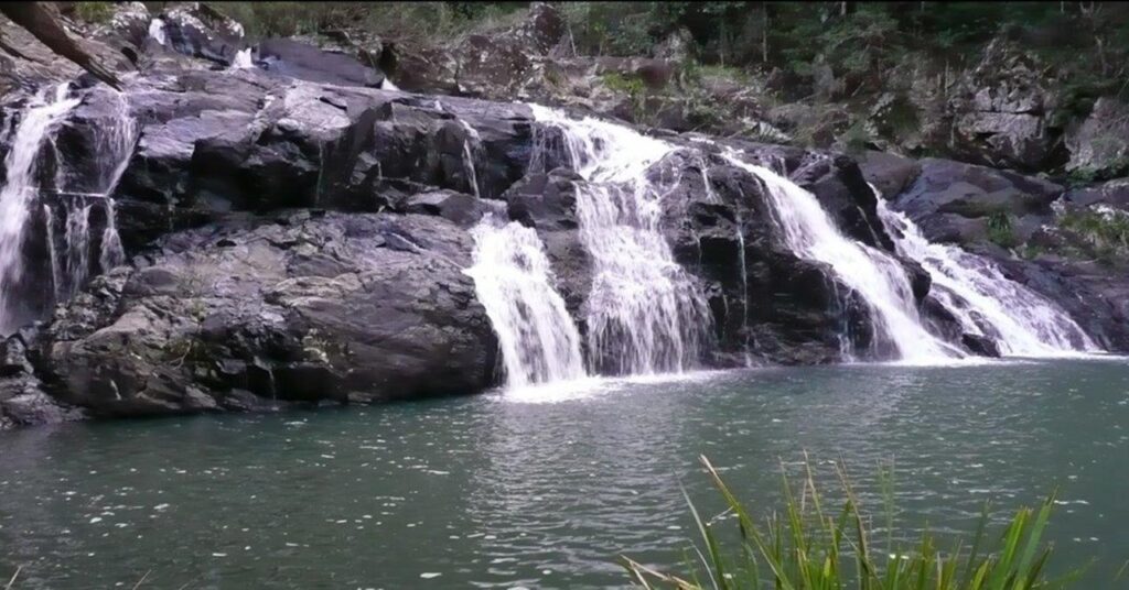
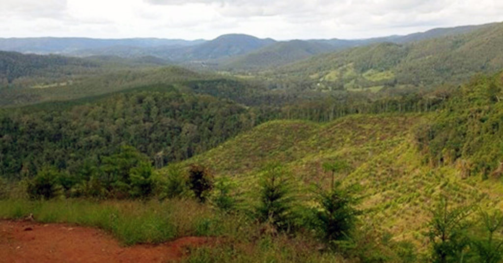
Conondale National Park
In the rugged Conondale Range are some of Queensland’s most popular and picturesque forests. Luxuriant rainforests, tall eucalypt forest, waterfalls, boulder-strewn creeks and spectacular scenery make this area well worth a visit.
This diverse 35,700ha park provides critical habitat for a wide variety of wildlife including a significant number of rare and threatened plants and animals. A large number of plant species that occur here are at the limit of their distribution. This park offers walking tracks, scenic drives and grassy campsites near rainforests and mountain streams. Popular Booloumba Creek camping areas are located beside a scenic rainforest lined creek. The Conondale Range Great Walk showcases the very best of Conondale National Park. Ancient rainforest, cascading waterfalls, crystal clear creeks, tall open forest, and expansive views are just some of the spectacular features of this walk. Visitors can take short strolls or complete the full four-day 56km circuit walk. Location – 15km south of Kenilworth township, and about one hour west of Maroochydore on the Sunshine Coast. 130km north of Brisbane Camping Grounds
|
Imbil State Forest
Magnificent forests, deep gorges and spectacular views walking tracks, scenic drives and grassy campsites near rainforests and mountain streams feature in the Imbil State Forest. Adjoining Conondale National Park, this area provides easy access to the features of both Imbil State Forest and Conondale National Park.
The diverse forests provide homes for a wonderful variety of wildlife including more than 120 species of birds and many mammals. The threatened and seldom-seen yellow-bellied glider lives in the open forest An easily accessible walk which is suitable for wheelchairs is Fig Tree Walk – a 1.4km track with some magnificent Morteon Bay Figs. The start of the circular walk is near the Yabba Creek Rest Area (where Booloumba Creek joins the Mary River) approximately 4km south of Kenilworth along the Maleny-Kenilworth Road. There are camping areas and mountain creeks. Popular with four-wheel drive enthusiasts, this forest is big enough for everyone. Location – About 150km north of Brisbane, inland from the Sunshine Coast Camping Grounds
|
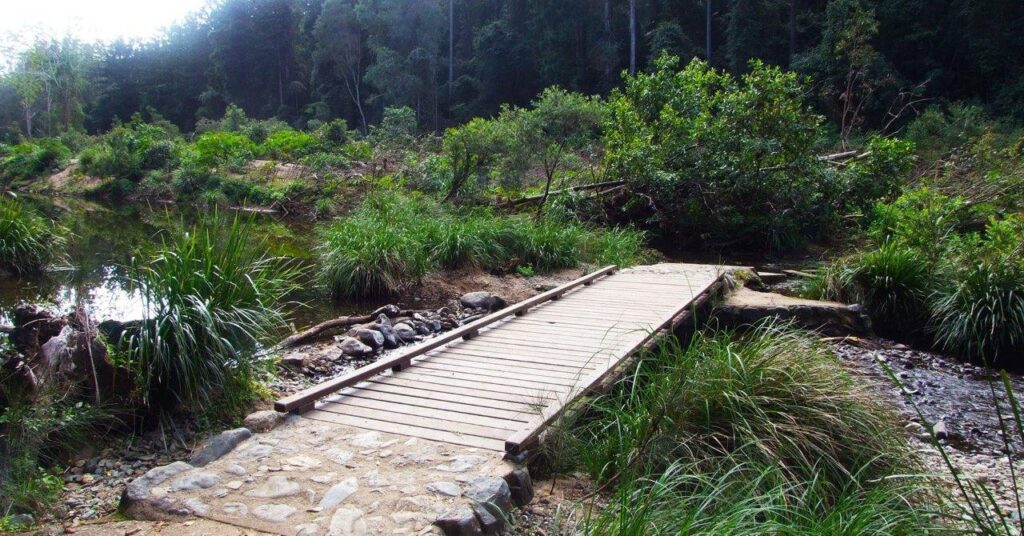
LITTLE YABBA CIRCUIT
Charlie Moreland Day-Use Area
1.8km return (allow 45 minutes) Grade 3 The same start and finish point, but the traveller doesn’t return along the same path. The circuit starts from the Charlie Moreland day-use area, where you can wade across Little Yabba Creek to explore hoop pine plantation and riparian rainforest. This is a fabulous area for bird watching. Creek banks lined with riparian rainforest provide the perfect habitat for local birdlife. Track-side signs are there to help identify these birds. Discover towering hoop pines before enjoying a cool swim in one of the waterholes in Little Yabba Creek. From Kenilworth, follow Maleny–Kenilworth Road for 7km and turn right onto Sunday Creek Road. Drive 5km to the day-use area. Wheelchair access – NO wheelchair-accessible facilities. LINK TO DES MAP & MORE INFORMATION HERE |
PICABEEN CIRCUIT
Charlie Moreland Cay-Use Area
3.5km return (allow 2 hours) Grade 3 An extension of the Little Yabba Circuit, this walk explores hoop pine plantation, riparian rainforest and a piccabeen palm grove. Admire the tall stands of native hoop pines originally planted in the mid-1900s by Charlie Moreland’s forest ranger crew. Piccabeen circuit is in Imbil State Forest, about 150km north of Brisbane or 60km south of Gympie. The circuit is an extension of Little Yabba circuit, which is accessed from Charlie Moreland day-use area. From Kenilworth, drive 7km south on the Maleny-Kenilworth road to the Sunday Creek Road intersection. Drive 5km along Sunday Creek Road to the Charlie Moreland camping and day-use areas. Wheelchair access – NO wheelchair-accessible facilities. LINK TO DES MAP & MORE INFORMATION HERE |
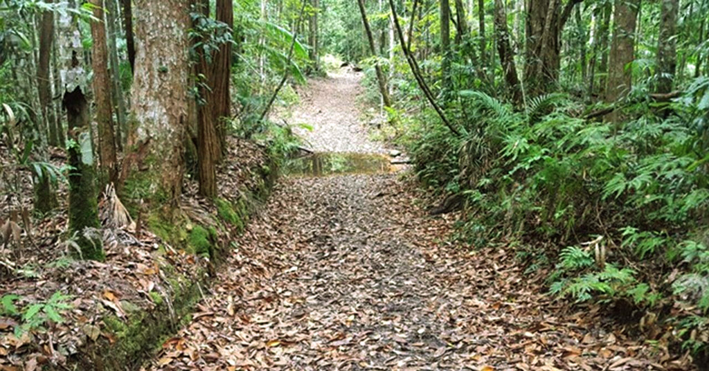
MT ALLEN SHARED TRAIL
Charlie Moreland Day-Use Area
8.8km return (Allow 4hrs walking time) Grade 4 This challenging hike is a shared trail with walkers, cyclists and horse riders. The final 300m to the Mt Allen firetower, however, is only for walkers, so leave your bike or horse at the hitching rail. You’ll pass through hoop-pine plantations as you head upwards to Mount Allan. Breathtaking scenery surrounds you and photographers will love the panoramas. Mount Allan shared trail is in Imbil State Forest on the Sunshine Coast, about 150km north of Brisbane or 60km south of Gympie. This trail is accessed from Charlie Moreland day-use area. From Kenilworth, follow Maleny–Kenilworth Road for 17km and turn right onto Sunday Creek Road. Drive 5km to the day-use area. Wheelchair access – NO wheelchair-accessible facilities LINK TO DES MAP & MORE INFORMATION HERE |

|
2023 Proudly brought to you by the Mary Valley Chamber of Commerce
Supporting and promoting Mary Valley Business |