|


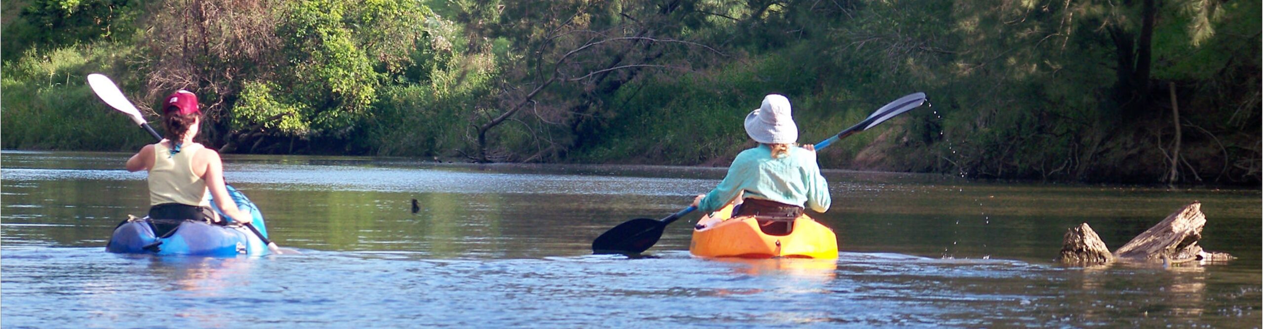
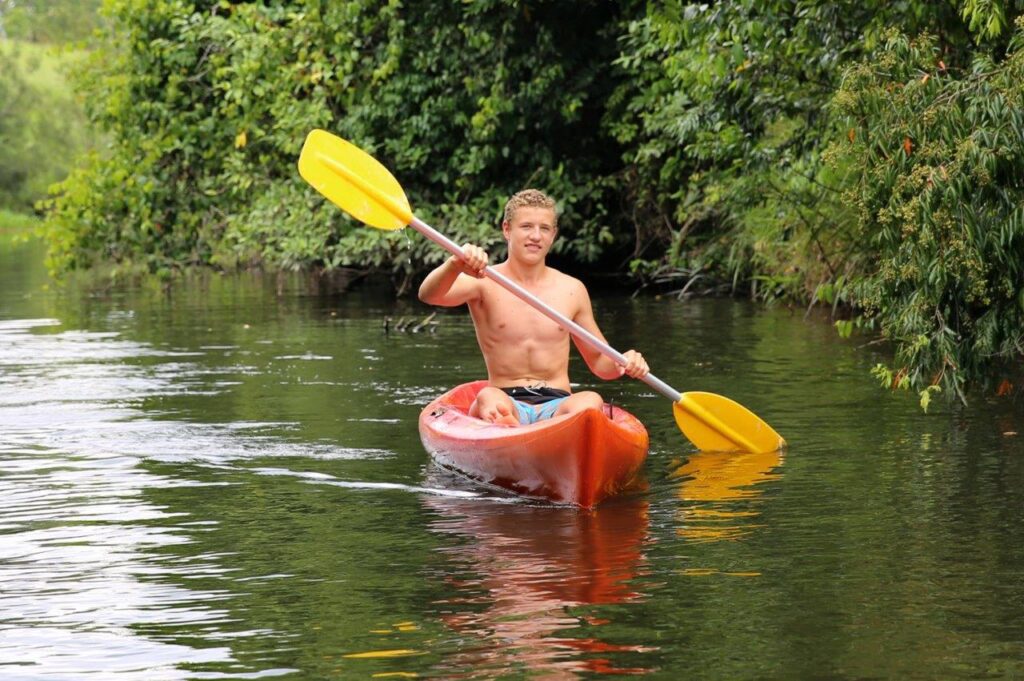
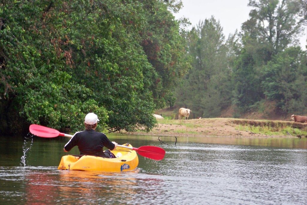
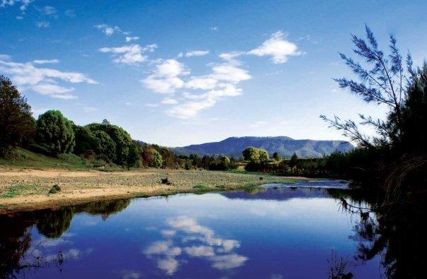
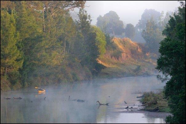
Few rivers in Queensland provide such an opportunity for an extended trip through pristine countryside. The Mary features an abundance of wildlife in and around the river that can’t be seen in many other places, and the untamed element of the upper reaches will excite adventure buffs. So, don’t delay! Grab a canoe, kayak or stand-up paddleboard and get out onto the Mary River today. Because there really is something about Mary… Read the full article HERE Thanks to Dan Owbridge Bush 'n Beach Fishing Magazine |
|
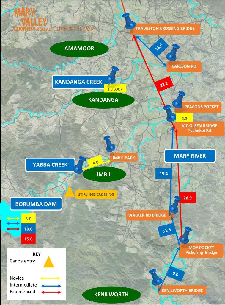
Imbil Town Bridge, Yabba Crk Canoe Launch
(4.6km loop) For those wanting a short paddle right in the middle of town, then this one is for you. This leisurely paddle up and down the stunning Yabba Creek through Imbil township is just 2km one-way, or you can do a the loop. The Imbil Canoe launch points can be accessed at Bert Smith Memorial Park (at Imbil Town Bridge) and upstream on Yabba Creek Road (400m west of Mathias St). Paddle upstream under the Heritage listed Rail Bridge or downstream to the local weir. The water levels in Yabba Creek are always deep and accessible. |
|
Kandanga Creek Canoe Trail Loop
(2 klm) You can find the Kandanga Creek Canoe entry point by parking at the old Kandanga Railway Station and taking the pathway to the weir. This is a 2km loop in incredibly secluded quiet waterways. Chances are you will see a platypus here as you glide quietly down stream. Great parking, slight slope down to creek, good steps and access. |
|
Kenilworth Bridge to Pickering Bridge, Moy Pocket
(approx 2hrs – 9 km) Launch at Charles Street in Kenilworth or at privately owned Kenilworth Homestead & camping ground. This section runs for 9km down to the Pickering Bridge on Moy Pocket Road. The water must be deep enough and flowing for the trip to be attempted. The exit point at the Pickering Bridge is on the southern side, downstream of the bridge |
|
Pickering Bridge, Moy Pocket to Walker Rd Bridge
(11.5km – approx 2hrs) A dirt road turns off next to the southern side of the bridge, and goes 50m to a gravel bank which makes for a good clean launch point. Exit is downstream of Walker Road Bridge. This section of the Mary River is stunning! It consists of clear, deep pools overlooked by sandstone cliffs, with native timber interspersed with twisty and quick flowing gravelly runs. It’s a short and reasonably challenging section of the river that should present no problems to paddlers with a bit of experience. Walkers Rd Bridge is not a great access point and has limited parking, though it may be OK to leave a car for a shuttle back to the departure point. Return trips on this section are not advisable. Another option is to carry on to Vic Olsen Bridge.* |
|
Walker Rd Bridge to Vic Olsen Bridge, Tuchekoi Rd
(15.4km – approx 5hrs) Road access is 5.5km North past the Pickering Bridge along Moy Pocket Road & 1km down Walker Road on the right. This is a no through road. The short track on the Northern downstream side of the bridge is a private road and should not be blocked. Note that heavy haul trucks often use the Moy Pocket Road. Launch point is just downstream of the bridge. The exit point at Vic Olsen Bridge, Tuchekoi Road is a steep haul on a tiny track the southern side. Similar to the Moy Pocket section, but slightly longer and with similar conditions. Allow adequate time to portage canoes and kayaks through the gravelly shallow sections on low water. As mentioned above, Walker Rd is not a great spot to park multiple cars, so arrangements should be made to car shuttle. Return trips on this section are not advisable. Another stunning section of the river* |
|
Pickering Bridge, Moy Pocket to Vic Olsen Bridge, Tuchekoi Rd
(at least 7-8 hrs) This section is 27km by river and can be quite demanding for one day. There is further road access 11km downstream from Pickering Bridge, on Walker Road Bridge. |
|
Vic Olsen Bridge – Walker Bridge – Tuchekoi Rd to Traveston Crossing
(22.2km – 6hrs) The launch point is a steep foot track on the southern side of Vic Olsen Bridge, right next to the bridge. From there it is 24km to Traveston Crossing by river. At the finish, exit either side. The southern side offers an easy gravel track. A longer section but somewhat easier because sections between shallows tend to be longer and deeper. This section will suit experienced paddlers because 22km is a long way to paddle in a day. Access points at Vic Olsen and Traveston are good and have been established, if informally, for quite some time. As with the upstream sections of the river, allow time to portage canoes and kayaks through shallow sections of low water at times.* |
|
Traveston Crossing to Carlson Rd and return
(14.6km) An easy section of the river to paddle without having to organise a car shuttle. Traveston Crossing is a good place to leave a car and access to the water is easy. The river is wider in this section and as a consequence the current is not too strong for the return journey. It’s still a pretty section of the river, with opportunities to see lungfish and turtles as you paddle along. The Mary is a seasonal river and as such river levels should be checked prior to departing on any section. Low water will mean a lot of carrying or dragging craft through shallow sections, which are often just too shallow to paddle through.* *Italicised sections are contributed from Dan Owbridge’s article in Bush ‘ Beach Fishing Magazine |
|
Here are some personal blogs from people who have paddled the Mary River.
CLICK TO READ ABOUT PADDLING THE MARY |

|
2023 Proudly brought to you by the Mary Valley Chamber of Commerce
Supporting and promoting Mary Valley Business |